About Aqua Map New York Lakes GPS
*** New exclusive function: mapXpan *** An app to satisfy all your Fishing and Boating's needs, developed with the help of professional fishermen. ► CHECK YOUR LAKE HERE BEFORE YOU BUY!:...
*** New exclusive function: mapXpan ***
An app to satisfy all your Fishing and Boating's needs, developed with the help of professional fishermen.
► CHECK YOUR LAKE HERE BEFORE YOU BUY!: http://www.globalaquamaps.com/NYViewer.html
You will be able to download the best maps and enjoy your new fishing season. Press the RECORD button, put the phone in your pocket and record your fishing trolling track....and much more.
►► Features:
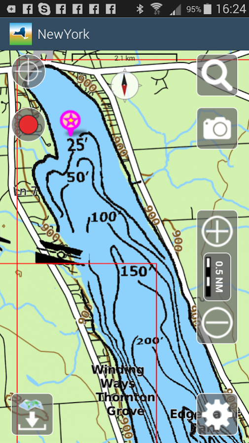
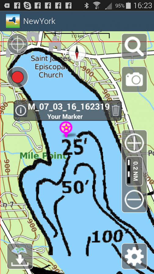
• Nautical Raster Charts presented at the best scale for each zoom level.
• User friendly interface.
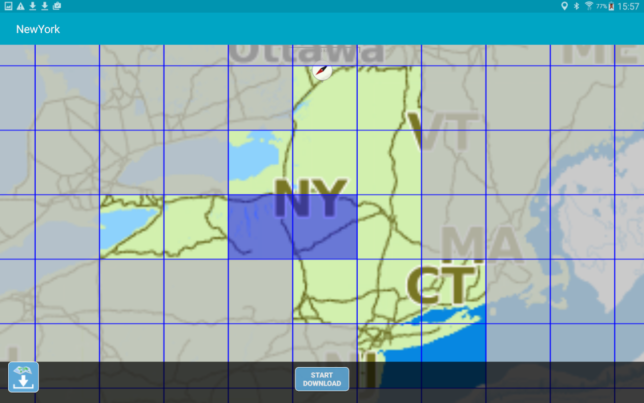
• You can download maps (for FREE, no additional purchase is required) on the device, to be used later without any internet connection.
• 250 New York lakes available, plus a complete topographic map to reach the most remote lakes and rivers.
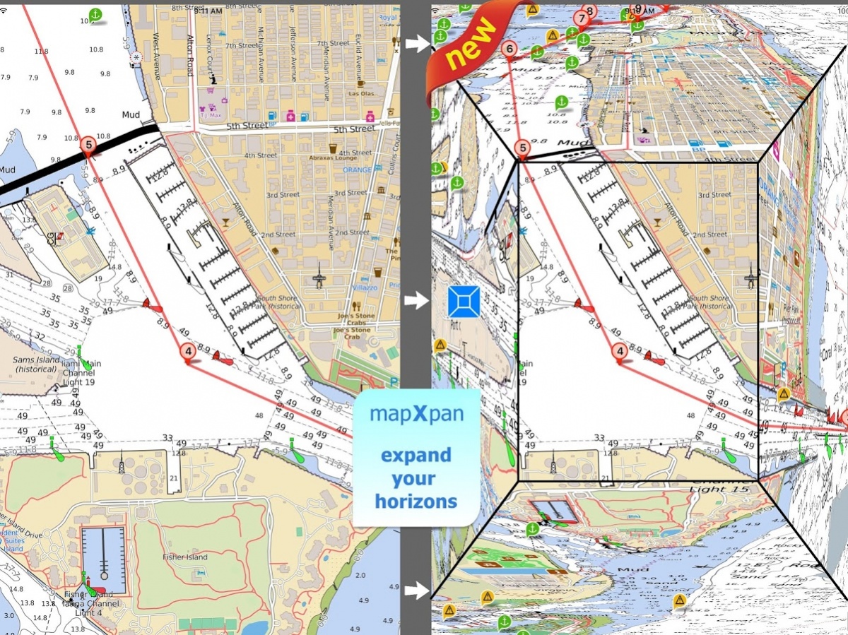
• *** NEW *** Expand your horizons with mapXpan (patent pending).
• Store your track without the need of cellular data or phone signal.
• No problem to receive/make phone calls and messages while recording the tracks.
• Share tracks, markers and pictures in various formats (KMZ and GPX).
• Store an unlimited number of tracks and markers.
• Customize your Marker's icon and Track's color.
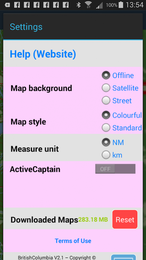
• Switch between Map display modes (Offline, Satellite, Roads).
• Measure distances on the map.
• Load any track and marker from internet communities (KMZ, KML, GPX also if zipped)
• Query map objects with your finger tip
• ActiveCaptain community integration
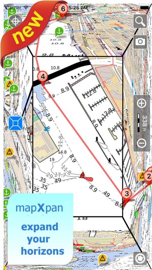
*** NEW ***
► mapXpan
This new mode will greatly extend your display; you will have the details you need for a safe navigation seamlessly integrated with a large overview area.
Using this new mode you will see a map 64 times larger than the standard mode without losing any detail in the center part of the screen.
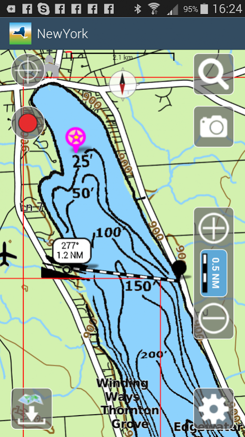
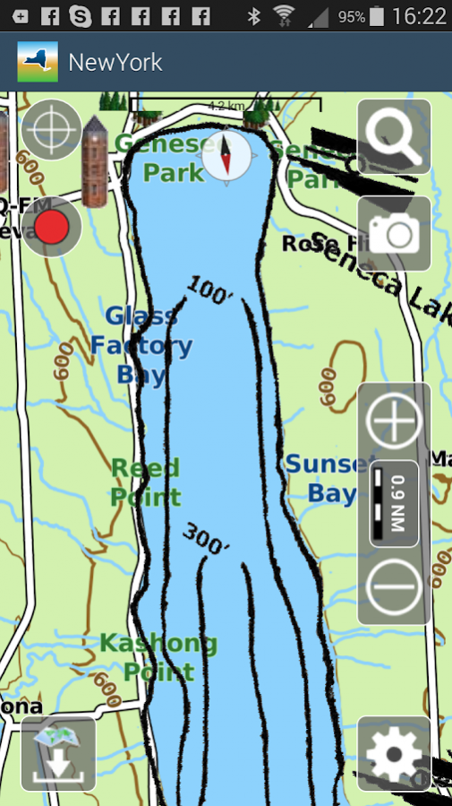
► MAPS
Aqua Map lets you download the best maps with depth contours, boat ramps, etc. but also a complete Topographic map with road network, trails, elevation contours, lakes, rivers, etc. and all it is necessary to enjoy your best outdoor experience, for FREE!! No additional purchase is required. You can download the maps at home within your device and then use them on the boat without any Internet connection need.
► SHARING
Why do not sharing your favorite's markers or sending an email with your last daily track, with all the pictures you captured to show them on Earth or Maps ? With Aqua Map it is just a click.
► LOADING OTHER's TRACKS AND MARKERS
Aqua Map can load any KML, KMZ, GPX (also zipped) you can find over the internet or received from your friends. You can load tracks and markers generated from any application (e.g. Google EarthTM, Maps, or other iPhone/iPad apps), obviously including Aqua Map, or any device (e.g. Garmin Etrex, Nuvi, Magellan, etc.).
► ENJOY ActiveCaptain Community
Join the community of more than 100.000 boaters who write reviews, update data and provide up to date hazard information on ActiveCaptain
View and contribute to the best marinas location database in the world
Read and contribute reviews and rating about marinas, shared local boating knowledge, anchorage and hazards
► BACKGROUND MODE
Aqua Map works also when in background, you can receive/make calls and messages while the track recording is running.
————
Like any GPS, the signal quality can vary very much depending by the amount of visible sky, foliage, weather condition, etc. GPS is not reliable indoor.
The continuous GPS usage, also in background, can drastically reduce the battery life.
For more information please visit our website at:
www.globalaquamaps.com or send us an email at:
[email protected]
Previous Versions
Here you can find the changelog of Aqua Map New York Lakes GPS since it was posted on our website on 2018-03-20 02:28:47.
The latest version is 5.2 and it was updated on 2024-04-19 20:53:00. See below the changes in each version.
Aqua Map New York Lakes GPS version 5.2
Updated At: 2018-01-29
Changes: - Made possible to customize the line width for tracks and routes
- The route info gives now the estimated arrival time at the end and for each waypoint
- Tapping on a track the time of the touched track point is given in the track info window
- When the map is touched the list of all objects and user data in the touched point is presented
- It is possible to go center the map at coordinates manually entered by the user